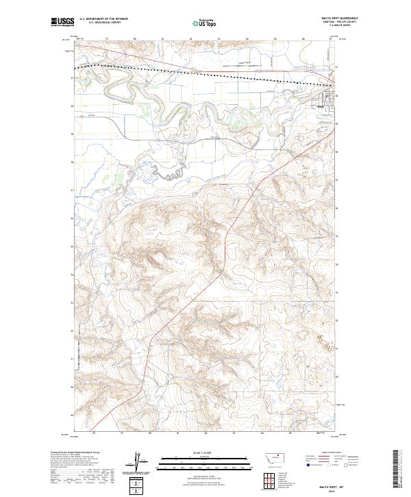
2024 Map of Malta West
USGS Topo · Published 2024About this map
Malta serves as the focal point of this northern Montana landscape, where the Milk River carves a winding path through the prairie. The town's significance as a local government seat is evidenced by the Phillips County Courthouse, situated near the river's edge. This area demonstrates a highly managed agricultural environment, defined by the extensive irrigation infrastructure of the Dodson North Canal and Dodson South Canal. Beyond the irrigated valley, the terrain shifts into the drainage patterns of Alkali Creek and the deep incisions of Taylor Coulee. Local transportation history is marked by the presence of Kid Curry Rd, named for the infamous outlaw, while the Malta Airport and various rural routes like Rte 363 connect the remote ranching and farming operations to the county center.
Find a feature on this map
30 named features on this map. Tap any name to fly to it.
Don’t see what you’re looking for? This feature index may not catch every label — zoom into the map to look around manually.
Map Details
Editions of this 2024 Malta West Map
This is the sole edition of this map. No revisions or reprints were ever made.
Other maps of this area

1953 · Havre
USGS Topo · 1:250,000

1954 · Glasgow
USGS Topo · 1:250,000

1957 · Glasgow
USGS Topo · 1:250,000

1957 · Havre
USGS Topo · 1:250,000

1958 · Glasgow
USGS Topo · 1:250,000

1958 · Havre
USGS Topo · 1:250,000

1964 · Dodson NE
USGS Topo · 1:24,000

1965 · Wagner
USGS Topo · 1:24,000

1965 · West Alkali Reservoir
USGS Topo · 1:24,000

1968 · Malta West
USGS Topo · 1:24,000