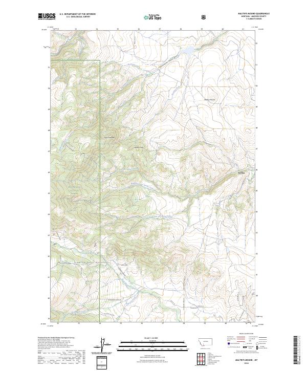
2024 Map of Maltbys Mound
USGS Topo · Published 2024About this map
The Tobacco Root Mountains dominate this high-elevation landscape in Madison County, where the historic mining and ranching legacies of southwest Montana are etched into the terrain. The settlement of Sterling sits at the eastern edge of the quadrangle, connected by Sterling Rd to a network of drainages including Hot Springs Creek and Norwegian Creek. The northern portion of the map is defined by industrial history along Norwegian Placer Gulch, while the western reach is largely contained within the protected boundaries of the Beaverhead National Forest. This modern survey reveals the complex drainage patterns of the North Fork, Middle Fork, and South Fork Hot Springs Creek, which flow through a region marked by prominent landmarks like Maltbys Mound and the Eagle Rock mine site.
Find a feature on this map
42 named features on this map. Tap any name to fly to it.
Don’t see what you’re looking for? This feature index may not catch every label — zoom into the map to look around manually.
Map Details
Editions of this 2024 Maltbys Mound Map
This is the sole edition of this map. No revisions or reprints were ever made.
Other maps of this area

1888 · Three Forks
USGS Topo · 1:250,000

1894 · Three Forks
USGS Topo · 1:250,000

1895 · Three Forks
USGS Topo · 1:250,000

1947 · Bozeman
USGS Topo · 1:250,000

1948 · Bozeman
USGS Topo · 1:250,000

1949 · Ennis
USGS Topo · 1:62,500

1949 · Norris
USGS Topo · 1:62,500

1950 · Harrison
USGS Topo · 1:62,500

1950 · Virginia City
USGS Topo · 1:62,500

1951 · Norris
USGS Topo · 1:62,500