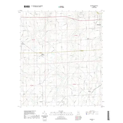
2020 Map of Malvern
USGS Topo · Published 2020About this map
Malvern and Slocomb anchor the southern landscape of this wiregrass region, where the borders of Houston and Geneva counties meet. The area is defined by a dense network of country roads and small creek drainages, including Gilley Mill Cr and Bear Cr. Genealogists will find significant value in the numerous local burial grounds such as Old Oak Grove Cem, Providence Cem, and Union Cem, which are often located near historic congregation sites like Bay Springs Baptist Church. The terrain shows the transition from the edge of Dothan in the northeast toward more rural crossroads such as Wicksburg and Bailey Crossroads. Water features like Emmett Sellers Lake and Panther Cr dictate the local topography, influencing the placement of original farmsteads and agricultural boundaries throughout the early 21st century.
Find a feature on this map
125 named features on this map. Tap any name to fly to it.
Don’t see what you’re looking for? This feature index may not catch every label — zoom into the map to look around manually.
Map Details
Editions of this 2020 Malvern Map
This is the sole edition of this map. No revisions or reprints were ever made.
Other maps of this area

1942 · Enterprise
USGS Topo · 1:125,000

1948 · Ozark
USGS Topo · 1:62,500

1950 · Ozark
USGS Topo · 1:62,500

1953 · Dothan
USGS Topo · 1:250,000

1954 · Dothan
USGS Topo · 1:250,000

1955 · Dothan
USGS Topo · 1:250,000

1957 · Malvern
USGS Topo · 1:24,000

1957 · Hartford
USGS Topo · 1:62,500
1957 · Hartford
USGS Topo · 1:24,000
1957 · Clayhatchee
USGS Topo · 1:24,000