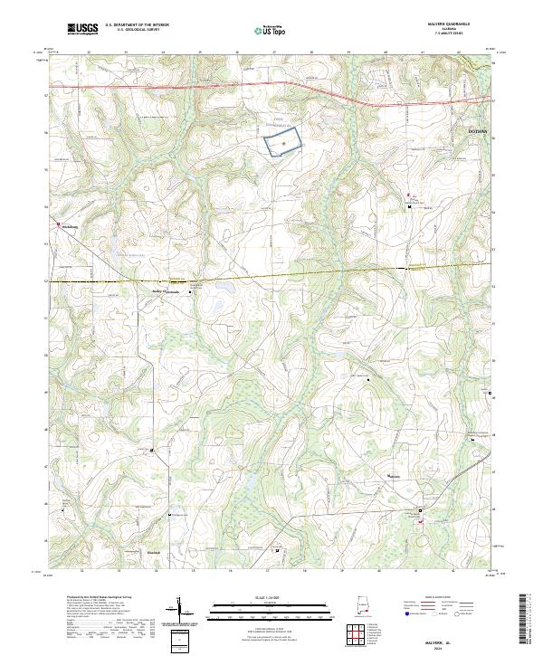
2024 Map of Malvern
USGS Topo · Published 2024About this map
Toth Stagefield AL sits at the center of this rural Wiregrass landscape, marking the intersection of military aviation history and deep-rooted agricultural communities. The terrain is defined by the winding paths of Panther Creek and Bear Creek, which separate small settlements like Malvern and Slocomb as they cross the Geneva and Houston County lines. Genealogists and local researchers will find a high concentration of historic burial grounds and congregations, including the Bethlehem Primitive Baptist Church Cem and the Old Grove Cem. The map illustrates a network of rural routes such as Bud Hagler Rd and Wicksburg Rd, connecting family farms to larger hubs like Wicksburg and the western outskirts of Dothan. This modern survey documents the persistent rural character of Southeast Alabama, where family-named landmarks like Emmett Sellers Lake continue to define the local geography.
Find a feature on this map
97 named features on this map. Tap any name to fly to it.
Don’t see what you’re looking for? This feature index may not catch every label — zoom into the map to look around manually.
Map Details
Editions of this 2024 Malvern Map
This is the sole edition of this map. No revisions or reprints were ever made.
Other maps of this area

1942 · Enterprise
USGS Topo · 1:125,000

1948 · Ozark
USGS Topo · 1:62,500

1950 · Ozark
USGS Topo · 1:62,500

1953 · Dothan
USGS Topo · 1:250,000

1954 · Dothan
USGS Topo · 1:250,000

1955 · Dothan
USGS Topo · 1:250,000

1957 · Malvern
USGS Topo · 1:24,000

1957 · Hartford
USGS Topo · 1:62,500
1957 · Hartford
USGS Topo · 1:24,000
1957 · Clayhatchee
USGS Topo · 1:24,000