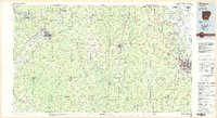
1985 Map of Malvern
USGS Topo · Published 1985About this map
Malvern sits at the western edge of this mid-1980s landscape, serving as a hub for the Missouri Pacific and Chicago Rock Island and Pacific railroads. The terrain transitions from the hills of Lake Catherine State Park and Easely Mtn in the northwest to the broader river basins of the Saline River and the Arkansas River in the east. Industry and infrastructure are prominent, evidenced by the expansive Pine Bluff Arsenal and the riverfront development at Pine Bluff Lake.
Find a feature on this map
99 named features on this map. Tap any name to fly to it.
Don’t see what you’re looking for? This feature index may not catch every label — zoom into the map to look around manually.
Map Details
Editions of this 1985 Malvern Map
2 editions found
Other maps of this area

1890 · Benton
USGS Topo · 1:125,000

1890 · Hot Springs
USGS Topo · 1:125,000

1891 · Little Rock
USGS Topo · 1:125,000

1893 · Little Rock
USGS Topo · 1:125,000

1894 · Hot Springs
USGS Topo · 1:125,000

1894 · Benton
USGS Topo · 1:125,000

1901 · Gurdon
USGS Topo · 1:125,000

1903 · Camden
USGS Topo · 1:125,000

1932 · Pastoria
USGS Topo · 1:62,500

1935 · Alexander
USGS Topo · 1:48,000