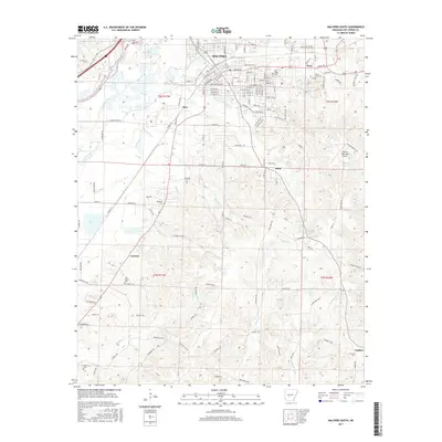
2017 Map of Malvern South
USGS Topo · Published 2017About this map
Malvern and its southern outskirts are defined by the winding course of the Ouachita River and a complex network of small tributaries. This landscape is shaped by the transition from the structured residential grid of the city to the more dispersed settlements of Abco, Perla, and Harp. The map reveals a high concentration of local history markers, including several family and community burial grounds such as Oak Ridge Cem, Ebenezer Cem, and Manning Cem. These sites, along with the Malvern Municipal Airport to the east, suggest a community where long-standing rural roots exist alongside modern infrastructure. Farther south, the terrain becomes more distinct with the drainage basins of Greasy Cr and Tenmile Cr, where smaller locales like Central and Landers are connected by timber roads and local trails, illustrating the enduring relationship between the local population and the wooded Arkansas landscape.
Find a feature on this map
152 named features on this map. Tap any name to fly to it.
Don’t see what you’re looking for? This feature index may not catch every label — zoom into the map to look around manually.
Map Details
Editions of this 2017 Malvern South Map
This is the sole edition of this map. No revisions or reprints were ever made.
Other maps of this area

1948 · Malvern
USGS Topo · 1:62,500

1949 · Malvern
USGS Topo · 1:62,500

1955 · Little Rock
USGS Topo · 1:250,000

1956 · Little Rock
USGS Topo · 1:250,000

1960 · Little Rock
USGS Topo · 1:250,000

1963 · Traskwood
USGS Topo · 1:24,000

1964 · Poyen
USGS Topo · 1:24,000

1964 · Little Rock
USGS Topo · 1:250,000

1964 · Donaldson
USGS Topo · 1:24,000

1965 · Round Hill
USGS Topo · 1:24,000