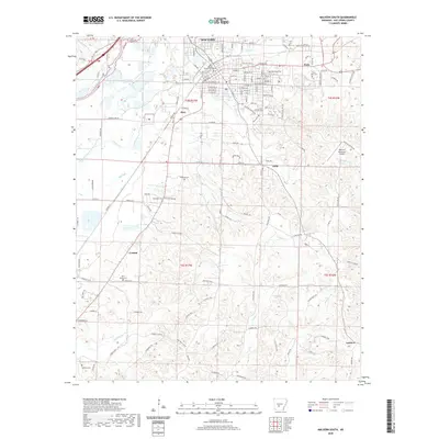
2020 Map of Malvern South
USGS Topo · Published 2020About this map
The Hot Spring County Courthouse serves as the focal point for Malvern in this detailed survey of the area south of the city center. The landscape transitions from the urban street grid of the county seat into the timbered hills and creek valleys of central Arkansas. Significant local history is preserved in the numerous burial grounds scattered across the townships, including Oak Ridge Cem, Perla Gate Cem, and the more remote Spencer Cem in the southwest.
Find a feature on this map
144 named features on this map. Tap any name to fly to it.
Don’t see what you’re looking for? This feature index may not catch every label — zoom into the map to look around manually.
Map Details
Editions of this 2020 Malvern South Map
This is the sole edition of this map. No revisions or reprints were ever made.
Other maps of this area

1948 · Malvern
USGS Topo · 1:62,500

1949 · Malvern
USGS Topo · 1:62,500

1955 · Little Rock
USGS Topo · 1:250,000

1956 · Little Rock
USGS Topo · 1:250,000

1960 · Little Rock
USGS Topo · 1:250,000

1963 · Traskwood
USGS Topo · 1:24,000

1964 · Poyen
USGS Topo · 1:24,000

1964 · Little Rock
USGS Topo · 1:250,000

1964 · Donaldson
USGS Topo · 1:24,000

1965 · Round Hill
USGS Topo · 1:24,000