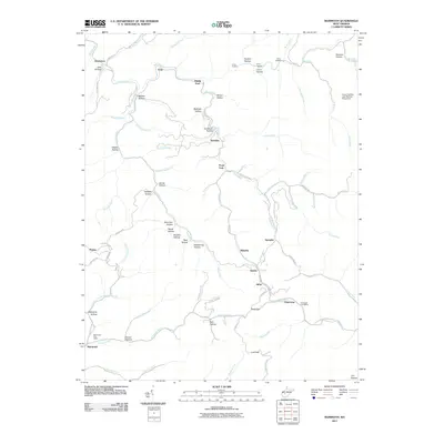
2011 Map of Mammoth
USGS Topo · Published 2011About this map
Mammoth Post Office and the southern settlement of Mammoth anchor a landscape defined by an intricate network of narrow hollows and creek forks in Kanawha County. The terrain is deeply dissected by Blue Creek and Kellys Creek, which serve as the primary conduits for local travel and settlement. Numerous small communities, including Kendalia, Blakeley, and Hitop, are situated at the confluences of various branches and forks, such as Pond Fork and Spangler Fork.
Find a feature on this map
76 named features on this map. Tap any name to fly to it.
Don’t see what you’re looking for? This feature index may not catch every label — zoom into the map to look around manually.
Map Details
Editions of this 2011 Mammoth Map
This is the sole edition of this map. No revisions or reprints were ever made.
Other maps of this area

1897 · Kanawha Falls
USGS Topo · 1:125,000

1900 · Kanawha Falls
USGS Topo · 1:125,000

1901 · Kanawha Falls
USGS Topo · 1:125,000

1907 · Clendenin
USGS Topo · 1:62,500

1908 · Clay
USGS Topo · 1:48,000

1908 · Fayetteville
USGS Topo · 1:48,000

1908 · Montgomery
USGS Topo · 1:48,000

1909 · Clendenin
USGS Topo · 1:62,500

1910 · Clay
USGS Topo · 1:62,500

1910 · Fayetteville
USGS Topo · 1:62,500