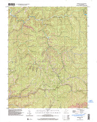
1996 Map of Mammoth
USGS Topo · Published 2003About this map
The rugged coal and timber lands of the Kanawha and Clay County border are defined by a dense network of mountain hollows and narrow creek valleys. Throughout the late twentieth century, the landscape remained characterized by small, isolated settlements like Kendalia, Blakeley, and Mammoth, often centered around a local post office or church. The presence of a Strip Mine near Hatcher Hollow and several oil wells indicates the region's continued reliance on resource extraction.
Find a feature on this map
64 named features on this map. Tap any name to fly to it.
Don’t see what you’re looking for? This feature index may not catch every label — zoom into the map to look around manually.
Map Details
Editions of this 1996 Mammoth Map
This is the sole edition of this map. No revisions or reprints were ever made.
Other maps of this area

1897 · Kanawha Falls
USGS Topo · 1:125,000

1900 · Kanawha Falls
USGS Topo · 1:125,000

1901 · Kanawha Falls
USGS Topo · 1:125,000

1907 · Clendenin
USGS Topo · 1:62,500

1908 · Clay
USGS Topo · 1:48,000

1908 · Fayetteville
USGS Topo · 1:48,000

1908 · Montgomery
USGS Topo · 1:48,000

1909 · Clendenin
USGS Topo · 1:62,500

1910 · Clay
USGS Topo · 1:62,500

1910 · Fayetteville
USGS Topo · 1:62,500