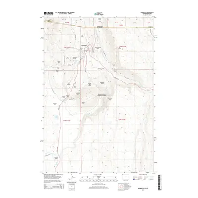
2015 Map of Mammoth
USGS Topo · Published 2015About this map
Mammoth serves as the administrative core and primary visitor hub for the northern section of Yellowstone National Park in 2015. This topographic study details the complex geothermal landscape surrounding Mammoth Hot Springs, where tiered mineral formations like Opal Terrace and Highland Terrace define the local terrain. The road network, including the Grand Loop Rd and N Entrance Rd, provides a clear view of how park infrastructure navigates the dramatic elevation changes of Capitol Hill and Kingman Pass. Beyond the developed areas, the map captures the transition from the thermal basins to the high peaks and deep incisions of Gardner Canyon and Sheepeater Canyon. To the south, the terrain opens toward Swan Lake and Gardners Hole, illustrating the diverse habitats preserved within the park's boundaries at the intersection of the Wyoming and Montana border.
Find a feature on this map
66 named features on this map. Tap any name to fly to it.
Don’t see what you’re looking for? This feature index may not catch every label — zoom into the map to look around manually.
Map Details
Editions of this 2015 Mammoth Map
This is the sole edition of this map. No revisions or reprints were ever made.
Other maps of this area

1885 · Gallatin
USGS Topo · 1:125,000

1885 · Gallatin
USGS Topo · 1:125,000

1891 · Livingston
USGS Topo · 1:250,000

1893 · Livingston
USGS Topo · 1:250,000

1901 · Gallatin
USGS Topo · 1:125,000

1908 · Gallatin
USGS Topo · 1:125,000

1911 · Gallatin
USGS Topo · 1:125,000

1947 · Bozeman
USGS Topo · 1:250,000

1948 · Bozeman
USGS Topo · 1:250,000

1955 · Bozeman
USGS Topo · 1:250,000