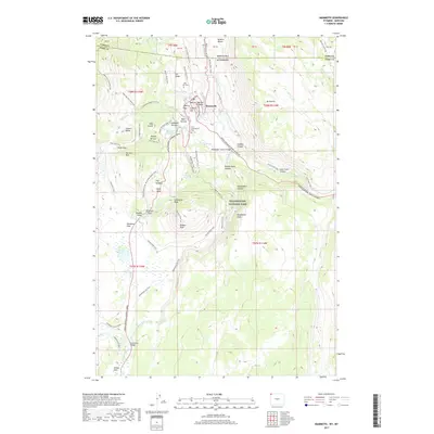
2017 Map of Mammoth
USGS Topo · Published 2017About this map
Fort Yellowstone and the administrative hub of Mammoth serve as the centerpiece of this northern corridor within Yellowstone National Park. The landscape is defined by hydrothermal and geological formations, including the Main Terrace, Highland Terrace, and the dramatic travertine steps of Opal Terrace. A complex network of historic routes and modern paths, such as the Old Gardner Road Trail and the Grand Loop Road, navigate the sharp elevation changes between McMinn Bench and the depths of Gardner Canyon. Historical points of interest like Kite Hill Cem and landmarks such as Liberty Cap reflect the long-standing human presence and early management of the park. From the thermal features near Squirrel Springs Ridge to the high vantage of Bunsen Peak, the map documents the confluence of natural wonders and the infrastructure built to access them, including the Sheepeater Canyon Bridge and the rugged Golden Gate Canyon.
Find a feature on this map
78 named features on this map. Tap any name to fly to it.
Don’t see what you’re looking for? This feature index may not catch every label — zoom into the map to look around manually.
Map Details
Editions of this 2017 Mammoth Map
This is the sole edition of this map. No revisions or reprints were ever made.
Other maps of this area

1885 · Gallatin
USGS Topo · 1:125,000

1885 · Gallatin
USGS Topo · 1:125,000

1891 · Livingston
USGS Topo · 1:250,000

1893 · Livingston
USGS Topo · 1:250,000

1901 · Gallatin
USGS Topo · 1:125,000

1908 · Gallatin
USGS Topo · 1:125,000

1911 · Gallatin
USGS Topo · 1:125,000

1947 · Bozeman
USGS Topo · 1:250,000

1948 · Bozeman
USGS Topo · 1:250,000

1955 · Bozeman
USGS Topo · 1:250,000