
1948 Map of Mammoth
USGS Topo · Published 1959About this map
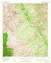
Mining operations and cattle ranching define the landscape of the San Pedro River valley in the years following the Second World War. The copper and gold industry is prominently represented by the Mammoth Mine, Mohawk Mine, and the developing San Manuel Copper Mine, complete with its associated tailings pond and cooling infrastructure near the settlement of Tiger. The map details the transition from industrial extraction to the rugged agricultural operations of the high desert, documenting numerous family-owned properties such as James Ranch, Sacaton Ranch, and the Kannally Ranch near the foothills of the Black Hills. To the southwest, the terrain rises sharply into the Coronado National Forest, where the higher elevations are marked by Signal Peak and the remote Campo Bonito site, while the valley floor is etched by a dense network of seasonal washes like Tucson Wash and Peppersauce Wash.
Find a feature on this map
57 named features on this map. Tap any name to fly to it.
Don’t see what you’re looking for? This feature index may not catch every label — zoom into the map to look around manually.
Map Details
Editions of this 1948 Mammoth Map
2 editions found
Other maps of this area

1904 · Tucson
USGS Topo · 1:125,000

1905 · Tucson
USGS Topo · 1:125,000

1911 · Winkelman
USGS Topo · 1:125,000

1913 · Winkelman
USGS Topo · 1:125,000

1938 · Galiuro Mts
USGS Topo · 1:48,000

1938 · Klondyke
USGS Topo · 1:48,000

1943 · Galiuro Mts
USGS Topo · 1:62,500

1943 · Klondyke
USGS Topo · 1:62,500

1945 · Redington
USGS Topo · 1:62,500

1948 · Clark Ranch
USGS Topo · 1:24,000