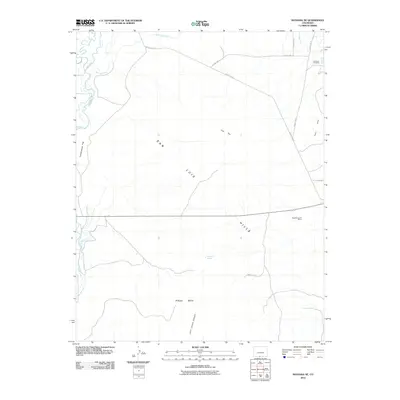
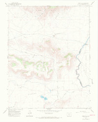
2010 Map of Manassa NE
USGS Topo · Published 2010About this map
San Luis Hills dominate the topography of this high-altitude landscape in Conejos County, where the desert floor meets rising volcanic elevations. The transition from the flatlands of Greasewood Flat to the broken terrain of the Fairy Hills and Piñon Hills is marked by a complex network of man-made irrigation infrastructure. Vital water sources like the Conejos River and Rio San Antonio feed an extensive system of canals, including the East Bend Ditch, Lasauses Ditch, and Rincon Ditch, which have historically supported agriculture in this arid environment. Evidence of local industry and community identity appears in the presence of the Kings Turquoise Mines and the Lasauses Cemetery, the latter serving as a permanent record of the families who settled this region of southern Colorado. The map also features notable natural landmarks such as Flat Top and the secluded Emory Orr Spring.
Find a feature on this map
20 named features on this map. Tap any name to fly to it.
Don’t see what you’re looking for? This feature index may not catch every label — zoom into the map to look around manually.
Map Details
Editions of this 2010 Manassa NE Map
This is the sole edition of this map. No revisions or reprints were ever made.
Other maps of this area

1954 · Trinidad
USGS Topo · 1:250,000

1955 · Trinidad
USGS Topo · 1:250,000

1958 · Trinidad
USGS Topo · 1:250,000

1959 · Trinidad
USGS Topo · 1:250,000

1965 · Lasauses
USGS Topo · 1:24,000

1967 · Manassa NE
USGS Topo · 1:24,000
1967 · Manassa
USGS Topo · 1:24,000
1967 · Lobatos
USGS Topo · 1:24,000
1967 · Sky Valley Ranch
USGS Topo · 1:24,000
1967 · Kiowa Hill
USGS Topo · 1:24,000