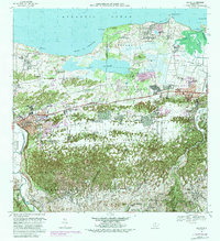
1969 Map of Manati
USGS Topo · Published 1988About this map
The Laguna Tortuguero basin and the coastal lowlands of northern Puerto Rico define this landscape during a period of significant urban expansion. The 1982 photorevision captures the growth of the Manati town center and the neighboring community of Vega Baja, highlighting the transition from traditional agrarian barrios like Coto Norte and Pugnado Afuera to denser residential settlements. The presence of the Campo Tortuguero U. S. Army Military Reservation and the National Guard Reservation near the coastline underscores the strategic military footprint in the region during the mid-20th century.
Find a feature on this map
89 named features on this map. Tap any name to fly to it.
Don’t see what you’re looking for? This feature index may not catch every label — zoom into the map to look around manually.
Map Details
Editions of this 1969 Manati Map
4 editions found
Other maps of this area

1940 · Vega Alta
USGS Topo · 1:30,000

1942 · Manati
USGS Topo · 1:30,000

1942 · Barceloneta
USGS Topo · 1:30,000

1946 · Corozal
USGS Topo · 1:30,000

1946 · Barceloneta
USGS Topo · 1:30,000

1946 · Ciales
USGS Topo · 1:30,000

1946 · Florida
USGS Topo · 1:30,000

1946 · Vega Alta
USGS Topo · 1:30,000

1946 · Manati
USGS Topo · 1:30,000

1947 · Corozal NO
USGS Topo · 1:10,000