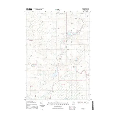
2016 Map of Manawa
USGS Topo · Published 2016About this map
Manawa serves as the primary hub of this East Central Wisconsin landscape, situated along the banks of the Little Wolf River where it widens into Manawa Pond. The surrounding geography is defined by a dense network of water bodies, from larger basins like Bear Lake and White Lake to smaller wetlands including Vesey Lake and Mountain Lake. The drainage pattern of the South Branch Little Wolf River carves through the southern portion of the sheet, revealing the glacial hydrology of Waupaca County.
Find a feature on this map
79 named features on this map. Tap any name to fly to it.
Don’t see what you’re looking for? This feature index may not catch every label — zoom into the map to look around manually.
Map Details
Editions of this 2016 Manawa Map
This is the sole edition of this map. No revisions or reprints were ever made.
Other maps of this area

1955 · Clintonville
USGS Topo · 1:48,000

1955 · Tigerton
USGS Topo · 1:48,000

1955 · Green Bay
USGS Topo · 1:250,000

1956 · Weyauwega
USGS Topo · 1:48,000

1957 · Waupaca
USGS Topo · 1:48,000

1969 · Readfield
USGS Topo · 1:24,000

1969 · Northport
USGS Topo · 1:24,000
1969 · Manawa
USGS Topo · 1:24,000
1969 · Weyauwega
USGS Topo · 1:24,000
1969 · Waupaca
USGS Topo · 1:24,000