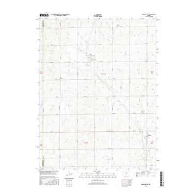
2016 Map of Manchester
USGS Topo · Published 2016About this map
Agricultural patterns and sections define the landscape of northern Dickinson County as it appeared in the mid-2010s. The small settlement of Manchester serves as a central hub, situated along Mud Cr near the intersection of Daisy Rd and Main St. To the southeast, Talmage anchors the lower portion of the map, illustrating the continued significance of these rural community centers in the Kansas plains.
Find a feature on this map
37 named features on this map. Tap any name to fly to it.
Don’t see what you’re looking for? This feature index may not catch every label — zoom into the map to look around manually.
Map Details
Editions of this 2016 Manchester Map
This is the sole edition of this map. No revisions or reprints were ever made.
Other maps of this area

1889 · Abilene
USGS Topo · 1:125,000

1891 · Clay Center
USGS Topo · 1:125,000

1894 · Abilene
USGS Topo · 1:125,000

1955 · Niles
USGS Topo · 1:24,000

1955 · Manhattan
USGS Topo · 1:250,000

1955 · Hutchinson
USGS Topo · 1:250,000

1956 · Manhattan
USGS Topo · 1:250,000

1957 · Manhattan
USGS Topo · 1:250,000

1959 · Hutchinson
USGS Topo · 1:250,000
1963 · Solomon
USGS Topo · 1:24,000