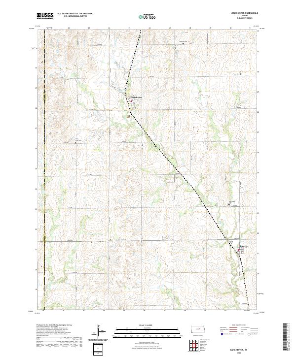
2022 Map of Manchester
USGS Topo · Published 2022About this map
Manchester and Talmage serve as the primary hubs of this agricultural landscape in northern Dickinson County. The terrain is characterized by the winding path of Mud Creek, which flows southeastward across the quadrangle, joined by smaller tributaries like Buckeye Creek. This 2022 survey documents a grid-like network of rural section roads, including Solomon Road along the border of Ottawa County. Genealogical interest is found in the distribution of local burial grounds, including Keystone Cem in the north, White Cloud Cem to the west, and Prairiedale Cem near the eastern margin. These landmarks, along with the precise township and range divisions like t11s r1e, provide a clear framework for researchers tracing land ownership and family history in this portion of the Kansas plains.
Find a feature on this map
39 named features on this map. Tap any name to fly to it.
Don’t see what you’re looking for? This feature index may not catch every label — zoom into the map to look around manually.
Map Details
Editions of this 2022 Manchester Map
This is the sole edition of this map. No revisions or reprints were ever made.
Other maps of this area

1889 · Abilene
USGS Topo · 1:125,000

1891 · Clay Center
USGS Topo · 1:125,000

1894 · Abilene
USGS Topo · 1:125,000

1955 · Niles
USGS Topo · 1:24,000

1955 · Manhattan
USGS Topo · 1:250,000

1955 · Hutchinson
USGS Topo · 1:250,000

1956 · Manhattan
USGS Topo · 1:250,000

1957 · Manhattan
USGS Topo · 1:250,000

1959 · Hutchinson
USGS Topo · 1:250,000
1963 · Solomon
USGS Topo · 1:24,000