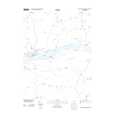
2013 Map of Manchester Islands
USGS Topo · Published 2013About this map
Manchester sits as a primary riverside hub along the Ohio River in this 2013 survey, where the river's path is defined by Manchester Island Number 1 and Manchester Island Number 2. The landscape north of the river in Ohio is marked by a high density of historical burial grounds, including the Odd Fellows Cem and the Manchester Second Street Cem. The terrain rises toward the north and south, featuring distinctive elevations such as Hymes Knob and Sulphur Knob, while the riverbank is dotted with access points like the Island Creek Boat Launch Ramp and Wells Landing. Smaller settlements like Bentonville, Wrightsville, and Fearisville anchor the surrounding rural road network, connected by routes like Cabin Creek Rd and Island Creek Rd that follow the natural contours of hollows like Williamson Hollow.
Find a feature on this map
115 named features on this map. Tap any name to fly to it.
Don’t see what you’re looking for? This feature index may not catch every label — zoom into the map to look around manually.
Map Details
Editions of this 2013 Manchester Islands Map
This is the sole edition of this map. No revisions or reprints were ever made.
Other maps of this area

1916 · Peebles
USGS Topo · 1:62,500

1918 · Peebles
USGS Topo · 1:62,500

1918 · Seaman
USGS Topo · 1:62,500

1919 · Vanceburg
USGS Topo · 1:62,500

1929 · Springdale
USGS Topo · 1:48,000

1935 · Springdale
USGS Topo · 1:62,500

1949 · Vanceburg
USGS Topo · 1:62,500

1949 · Concord
USGS Topo · 1:24,000

1949 · Charters
USGS Topo · 1:24,000

1950 · Charters
USGS Topo · 1:24,000