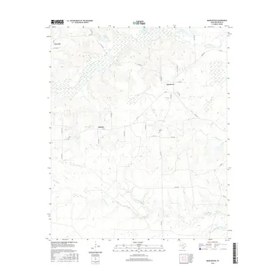
2016 Map of Manchester
USGS Topo · Published 2016About this map
Manchester and the surrounding Red River County landscape are defined by a complex network of seasonal bayous and creek bottoms that transition into managed timber and agricultural tracts. This 2016 survey captures the rural character of northern Texas, where small crossroads settlements like Addielou and Kanawha anchor a sparse grid of country roads. The hydrology of the region is notably prominent, with the branching reaches of Big Pine Cr and the meandering Pecan Bayou creating a distinctive drainage pattern across the terrain. These watercourses are punctuated by numerous small bodies of water, such as Flag Pond and Cowper Lake, which highlight the low-lying, wetland nature of the local geography. Genealogical interest centers on sites like Calhoun Cem, situated south of Manchester, providing a clear focal point for local family history research in this quiet pocket of the Texas-Red River corridor.
Find a feature on this map
41 named features on this map. Tap any name to fly to it.
Don’t see what you’re looking for? This feature index may not catch every label — zoom into the map to look around manually.
Map Details
Editions of this 2016 Manchester Map
This is the sole edition of this map. No revisions or reprints were ever made.
Other maps of this area

1951 · Frogville
USGS Topo · 1:24,000

1951 · Millerton
USGS Topo · 1:24,000

1951 · Negley
USGS Topo · 1:24,000

1951 · Kiomatia
USGS Topo · 1:24,000

1951 · Woodland
USGS Topo · 1:24,000

1951 · Manchester
USGS Topo · 1:24,000

1953 · Texarkana
USGS Topo · 1:250,000

1956 · Texarkana
USGS Topo · 1:250,000

1964 · Detroit
USGS Topo · 1:24,000

1964 · Bagwell
USGS Topo · 1:24,000