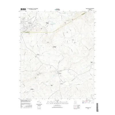
2017 Map of Manchester
USGS Topo · Published 2017About this map
Manchester stands at the northwestern edge of this landscape, where the street grid of the town meets the undulating terrain of Pine Mtn. The geography is defined by a series of prominent gaps and ridges, including Milen Gap, Dunn Gap, and Stephenson Gap, which historically dictated the flow of travel and commerce between Meriwether Co and Talbot Co. Further south, the town of Woodland is situated near Ransome Lake and Woodland Lake, serving as a local hub for the surrounding rural communities.
Find a feature on this map
93 named features on this map. Tap any name to fly to it.
Don’t see what you’re looking for? This feature index may not catch every label — zoom into the map to look around manually.
Map Details
Editions of this 2017 Manchester Map
This is the sole edition of this map. No revisions or reprints were ever made.
Other maps of this area

1907 · Talbotton
USGS Topo · 1:125,000

1934 · Warm Springs
USGS Topo · 1:62,500

1935 · Thomaston
USGS Topo · 1:48,000

1936 · Warm Springs
USGS Topo · 1:62,500

1939 · Thomaston
USGS Topo · 1:62,500

1950 · Talbotton
USGS Topo · 1:24,000

1950 · Waverly Hall
USGS Topo · 1:24,000

1950 · Talbotton
USGS Topo · 1:62,500

1955 · Talbotton
USGS Topo · 1:24,000
1955 · Waverly Hall
USGS Topo · 1:24,000