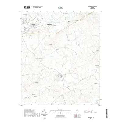
2020 Map of Manchester
USGS Topo · Published 2020About this map
Manchester anchor's the northern edge of this landscape where the Meriwether Co and Talbot Co boundary lines intersect. The terrain is defined by the prominent ridge of Pine Mtn, punctuated by several significant passes including Milen Gap, Mitchell Gap, and Patrick Gap. This topography heavily influenced the local road network and settlement patterns, with several small communities and crossroads emerging in the valleys and at the base of the mountains.
Find a feature on this map
117 named features on this map. Tap any name to fly to it.
Don’t see what you’re looking for? This feature index may not catch every label — zoom into the map to look around manually.
Map Details
Editions of this 2020 Manchester Map
This is the sole edition of this map. No revisions or reprints were ever made.
Other maps of this area

1907 · Talbotton
USGS Topo · 1:125,000

1934 · Warm Springs
USGS Topo · 1:62,500

1935 · Thomaston
USGS Topo · 1:48,000

1936 · Warm Springs
USGS Topo · 1:62,500

1939 · Thomaston
USGS Topo · 1:62,500

1950 · Talbotton
USGS Topo · 1:24,000

1950 · Waverly Hall
USGS Topo · 1:24,000

1950 · Talbotton
USGS Topo · 1:62,500

1955 · Talbotton
USGS Topo · 1:24,000
1955 · Waverly Hall
USGS Topo · 1:24,000