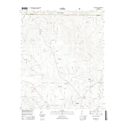
2014 Map of Manchester
USGS Topo · Published 2014About this map
Lewis Smith Lake and the southern fringes of the William B. Bankhead National Forest define the northern reaches of this Walker County landscape. The terrain is deeply carved by water, with Blackwater Creek and its many tributaries, such as Charlies Cr and Crooked Cr, winding through the hills. This network of waterways is crossed by several named structures, including Johnsey Bridge, Harris Bridge, and Shields Bridge, which connect the small rural communities of Manchester, Thach, and Marigold. At the southern edge, the map transitions into the more developed outskirts of Jasper, where the Walker County Airport-Bevill Field sits as a modern landmark. For genealogists, the map is a primary source for locating family burials at small rural plots like Old Bennett Cem, Gaddy Cem, and Edgil Grove Cem, reflecting the deep-rooted settlement patterns of the area.
Find a feature on this map
137 named features on this map. Tap any name to fly to it.
Don’t see what you’re looking for? This feature index may not catch every label — zoom into the map to look around manually.
Map Details
Editions of this 2014 Manchester Map
This is the sole edition of this map. No revisions or reprints were ever made.
Other maps of this area

1893 · Jasper
USGS Topo · 1:125,000

1949 · Cordova
USGS Topo · 1:24,000

1949 · Townley
USGS Topo · 1:24,000

1949 · Jasper
USGS Topo · 1:24,000

1949 · Manchester
USGS Topo · 1:24,000

1949 · Nauvoo
USGS Topo · 1:24,000

1949 · Sunlight
USGS Topo · 1:24,000

1950 · Nauvoo
USGS Topo · 1:24,000

1950 · Manchester
USGS Topo · 1:24,000

1951 · Jasper
USGS Topo · 1:24,000