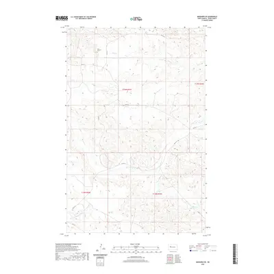
2020 Map of Mandaree NE
USGS Topo · Published 2020About this map
Saint Anthony's Cem stands as a primary landmark in this upland landscape within Dunn County, situated just north of Skunk Cr. The terrain is defined by a dense network of coulees and ridges typical of the Missouri Plateau, where the land has been deeply carved by drainage systems feeding into Squaw Cr. These watercourses dictate the placement of transportation routes, including Bia Rd 10 and Bia Rte 12, which follow the higher ground and natural contours of the territory. This map captures the rural character of the area within the Fort Berthold Indian Reservation boundaries, showing a sparse settlement pattern dominated by the township lines of t149n r93w and t148n r93w. The modern infrastructure of Bureau of Indian Affairs routes connects the isolated plateaus, providing a clear view of the contemporary road network through the varied elevation of the North Dakota badlands.
Find a feature on this map
13 named features on this map. Tap any name to fly to it.
Don’t see what you’re looking for? This feature index may not catch every label — zoom into the map to look around manually.
Map Details
Editions of this 2020 Mandaree NE Map
This is the sole edition of this map. No revisions or reprints were ever made.
Other maps of this area

1953 · Watford City
USGS Topo · 1:250,000

1957 · Watford City
USGS Topo · 1:250,000

1967 · Watford City
USGS Topo · 1:250,000

1967 · Sanish SE
USGS Topo · 1:24,000

1967 · New Town SW
USGS Topo · 1:24,000

1967 · Sanish SW
USGS Topo · 1:24,000

1970 · Mandaree
USGS Topo · 1:24,000

1970 · String Buttes
USGS Topo · 1:24,000

1970 · Mandaree SW
USGS Topo · 1:24,000

1970 · Mandaree SE
USGS Topo · 1:24,000