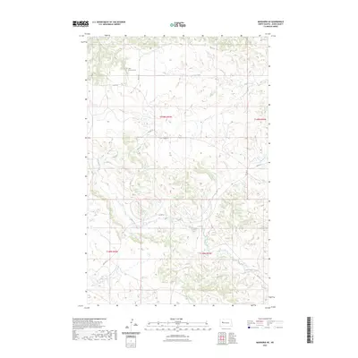
2023 Map of Mandaree NE
USGS Topo · Published 2023About this map
Saint Anthony's Cem stands as a quiet focal point in this section of Dunn County, positioned near the headwaters of Skunk Creek. The landscape is defined by the winding drainages of the Sakakawea Creek system, which carves through the Missouri Plateau terrain. This 2023 survey by the U.S. Geological Survey illustrates a modern infrastructure of Bureau of Indian Affairs routes, including Bia Rte 12 and Bia Rte 14, which provide access through the rolling breaks and upland plains. The absence of dense town sites highlights the rural character of the area, where land is primarily organized by the Public Land Survey System, as seen in the prominent township markers for t149n r93w and surrounding sections. For those researching local lineages or land use, the placement of the cemetery and the network of BIA roads offers a clear framework for identifying historical property boundaries and community landmarks.
Find a feature on this map
14 named features on this map. Tap any name to fly to it.
Don’t see what you’re looking for? This feature index may not catch every label — zoom into the map to look around manually.
Map Details
Editions of this 2023 Mandaree NE Map
This is the sole edition of this map. No revisions or reprints were ever made.
Other maps of this area

1953 · Watford City
USGS Topo · 1:250,000

1957 · Watford City
USGS Topo · 1:250,000

1967 · Watford City
USGS Topo · 1:250,000

1967 · Sanish SE
USGS Topo · 1:24,000

1967 · New Town SW
USGS Topo · 1:24,000

1967 · Sanish SW
USGS Topo · 1:24,000

1970 · Mandaree
USGS Topo · 1:24,000

1970 · String Buttes
USGS Topo · 1:24,000

1970 · Mandaree SW
USGS Topo · 1:24,000

1970 · Mandaree SE
USGS Topo · 1:24,000