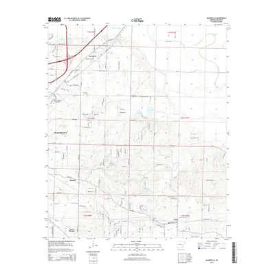
2014 Map of Mandeville
USGS Topo · Published 2014About this map
Texarkana and its eastern Miller County environs are captured here just after the turn of the decade, showing a landscape defined by small rural communities and extensive hydrology. The Texarkana Regional Airport-Webb Field stands as a primary landmark on the western edge, while to the east, the terrain transitions into a complex network of waterways including Bois d'Arc Bayou, Finn Bayou, and the winding Forky Deer Cr. Settlement patterns follow the established road and rail corridors, connecting smaller hubs like Mandeville, Rondo, and Genoa. Genealogists will find significant value in the distribution of family and community burial grounds, such as Cleveland Cem, Rondo Cem, and Harrison Chapel Cem. The map also documents curiously named local features such as Coca Cola Lake and Old Bitty Lake, alongside numerous creeks like Mill Cr and Comer Br that drain the low-lying basin toward the Red River valley.
Find a feature on this map
162 named features on this map. Tap any name to fly to it.
Don’t see what you’re looking for? This feature index may not catch every label — zoom into the map to look around manually.
Map Details
Editions of this 2014 Mandeville Map
This is the sole edition of this map. No revisions or reprints were ever made.
Other maps of this area

1909 · Texarkana
USGS Topo · 1:62,500

1950 · Ogden
USGS Topo · 1:24,000

1951 · Ogden
USGS Topo · 1:24,000

1951 · Homan
USGS Topo · 1:24,000

1951 · Fulton
USGS Topo · 1:24,000

1952 · Mandeville
USGS Topo · 1:24,000

1952 · Fouke SE
USGS Topo · 1:24,000

1952 · Fouke
USGS Topo · 1:24,000

1952 · Fouke NE
USGS Topo · 1:24,000

1953 · Texarkana
USGS Topo · 1:250,000