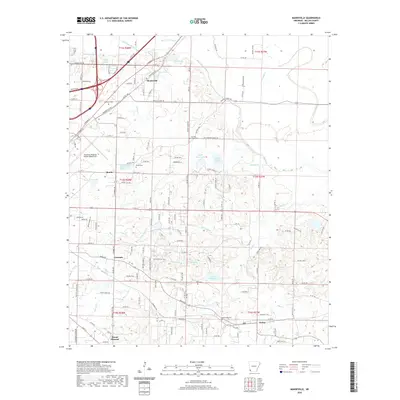
2020 Map of Mandeville
USGS Topo · Published 2020About this map
McKinney Bayou and Bois d'Arc Bayou snake through this corner of Miller County, defining a landscape of low-lying wetlands and scattered lakes east of the Texas border. The area is anchored by the Texarkana Regional Airport-Webb Field, while the surrounding countryside retains its rural character through small settlements like Mandeville and Genoa. This 2020 survey provides exceptional detail for genealogists, documenting numerous local burial grounds including Cleveland Cem, Rondo Cem, and Mount Oba Cem. The map illustrates a complex drainage network where Turkey Cr and Finn Bayou feed into larger systems, punctuated by local landmarks such as Camp Preston Hunt and the curiously named Coca Cola Lake. A dense network of county roads connects these communities, showing the modern footprint of historical townships like Rondo and Gertrude.
Find a feature on this map
110 named features on this map. Tap any name to fly to it.
Don’t see what you’re looking for? This feature index may not catch every label — zoom into the map to look around manually.
Map Details
Editions of this 2020 Mandeville Map
This is the sole edition of this map. No revisions or reprints were ever made.
Other maps of this area

1909 · Texarkana
USGS Topo · 1:62,500

1950 · Ogden
USGS Topo · 1:24,000

1951 · Ogden
USGS Topo · 1:24,000

1951 · Homan
USGS Topo · 1:24,000

1951 · Fulton
USGS Topo · 1:24,000

1952 · Mandeville
USGS Topo · 1:24,000

1952 · Fouke SE
USGS Topo · 1:24,000

1952 · Fouke
USGS Topo · 1:24,000

1952 · Fouke NE
USGS Topo · 1:24,000

1953 · Texarkana
USGS Topo · 1:250,000