
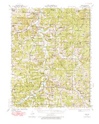
1941 Map of Manes
USGS Topo · Published 1965About this map
The Gasconade River carves a winding path through the northern half of this Missouri Ozarks terrain, creating a complex network of ridges and hollows such as Wichita Hollow and Wolf Hollow. In the early 1940s, this landscape was dotted with small agricultural settlements and communal hubs like Manes, Lynchburg, and Competition. The rural economy of the era is evidenced by local landmarks such as Grimes Mill and Latham Mill located along the waterways, which served as essential processing points for the surrounding farmsteads.
Find a feature on this map
89 named features on this map. Tap any name to fly to it.
Don’t see what you’re looking for? This feature index may not catch every label — zoom into the map to look around manually.
Map Details
Editions of this 1941 Manes Map
2 editions found
Other maps of this area

1931 · Manes
USGS Topo · 1:48,000

1941 · Big Piney
USGS Topo · 1:62,500

1941 · Lebanon
USGS Topo · 1:62,500

1941 · Bado
USGS Topo · 1:62,500

1943 · Lebanon
USGS Topo · 1:62,500

1943 · Big Piney
USGS Topo · 1:62,500

1943 · Manes
USGS Topo · 1:62,500

1943 · Drynob
USGS Topo · 1:62,500

1943 · Bado
USGS Topo · 1:62,500

1951 · Mountain Grove North
USGS Topo · 1:24,000