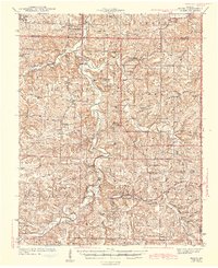
1943 Map of Manes
USGS Topo · Published 1943About this map
The Gasconade River meanders through a landscape defined by small rural hubs and a remarkable concentration of district schools in the early 1940s. Water-powered industry remains evident in the southern reaches at Latham Mill and Grimes Mill, while the surrounding hills of the Mark Twain National Forest are dotted with family and community landmarks like Doris Cem. The map documents a time when one-room schools such as Victory Sch, Sycamore Sch, and Cheerful Hill Sch were still the bedrock of local education.
Find a feature on this map
72 named features on this map. Tap any name to fly to it.
Don’t see what you’re looking for? This feature index may not catch every label — zoom into the map to look around manually.
Map Details
Editions of this 1943 Manes Map
3 editions found
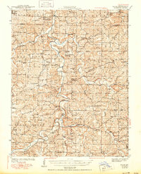
Other maps of this area

1931 · Manes
USGS Topo · 1:48,000

1941 · Big Piney
USGS Topo · 1:62,500

1941 · Manes
USGS Topo · 1:62,500

1941 · Lebanon
USGS Topo · 1:62,500

1941 · Bado
USGS Topo · 1:62,500

1943 · Lebanon
USGS Topo · 1:62,500

1943 · Big Piney
USGS Topo · 1:62,500

1943 · Manes
USGS Topo · 1:62,500

1943 · Drynob
USGS Topo · 1:62,500

1943 · Bado
USGS Topo · 1:62,500