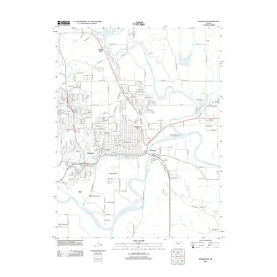
2012 Map of Manhattan
USGS Topo · Published 2012About this map
The confluence of the Big Blue River and the Kansas River anchors this detailed study of the city and its surrounding valley. Education and public life are central to the landscape, dominated by the sprawling grounds of Kansas State Univ and specialized institutions like Manhattan Area Technical Coll and Manhattan Christian Coll. The map traces the city's growth across varied terrain, from the residential areas atop Bluemont Hill and Stagg Hill to the fertile stretches of Moehlman Bottoms and Ashland Bottoms. Local history is preserved in sites like the Larry Norvell Band Shell and Sunset Cem, while the industrial and transport infrastructure is represented by the McDowell Creek Spur and the Manhattan Wastewater Treatment Facility. Small settlements such as Rocky Ford and Fairmont sit just outside the urban core, illustrating the relationship between the river-bottom agriculture and the expanding collegiate city.
Find a feature on this map
142 named features on this map. Tap any name to fly to it.
Don’t see what you’re looking for? This feature index may not catch every label — zoom into the map to look around manually.
Map Details
Editions of this 2012 Manhattan Map
This is the sole edition of this map. No revisions or reprints were ever made.
Other maps of this area

1886 · Junction City
USGS Topo · 1:125,000

1889 · Wamego
USGS Topo · 1:125,000

1889 · Junction City
USGS Topo · 1:125,000

1894 · Junction City
USGS Topo · 1:125,000

1894 · Wamego
USGS Topo · 1:125,000

1947 · Manhattan
USGS Topo · 1:62,500

1950 · Keats
USGS Topo · 1:24,000

1950 · Manhattan
USGS Topo · 1:24,000

1951 · Swede Creek
USGS Topo · 1:24,000

1951 · Ogden
USGS Topo · 1:24,000