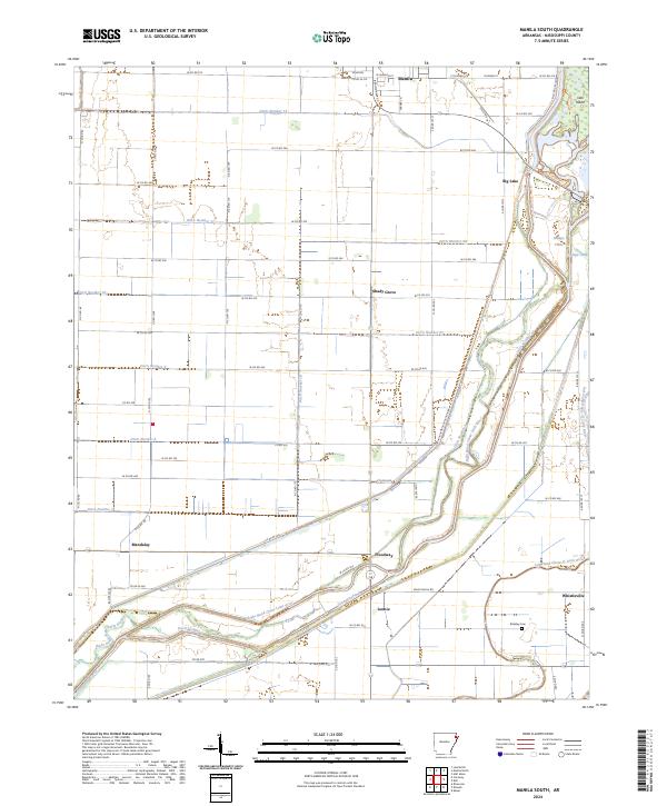
2024 Map of Manila South
USGS Topo · Published 2024About this map
Big Lake National Wildlife Refuge and its surrounding wetlands dominate the eastern edge of this landscape, where the Right Hand Chute Little River and Left Hand Chute of Little River wind through a complex system of drainage infrastructure. This network of engineered waterways, including Ditch Number 13 and Ditch Number 20, illustrates the intensive hydrological management required for this Mississippi County region. Small settlements like Shady Grove, Mandalay, and Whistleville are scattered across the plain, linked by a grid of county roads that navigate between the chutes and bayous. In the south, the Brinkley Cem stands as a focal point for genealogical research near the community of Lennie. The transition from the protected waters of Big Lake to the agricultural reaches of Manila highlights the duality of conservation and land use in this corner of Arkansas.
Find a feature on this map
68 named features on this map. Tap any name to fly to it.
Don’t see what you’re looking for? This feature index may not catch every label — zoom into the map to look around manually.
Map Details
Editions of this 2024 Manila South Map
This is the sole edition of this map. No revisions or reprints were ever made.
Other maps of this area

1939 · Evadale
USGS Topo · 1:62,500

1941 · Leachville
USGS Topo · 1:62,500

1941 · Manila
USGS Topo · 1:62,500

1941 · Marked Tree
USGS Topo · 1:62,500

1953 · Memphis
USGS Topo · 1:250,000

1956 · Leachville
USGS Topo · 1:62,500

1956 · Manila
USGS Topo · 1:62,500

1956 · Evadale
USGS Topo · 1:62,500

1956 · Marked Tree
USGS Topo · 1:62,500

1956 · Memphis
USGS Topo · 1:250,000