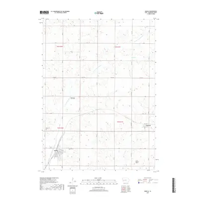
2018 Map of Manilla
USGS Topo · Published 2018About this map
Manilla serves as the primary hub of this western Iowa landscape, where the town street grid includes historically significant corridors such as Railway St and Main St. The surrounding countryside in Crawford County is defined by the winding course of the W Fork W Nishnabotna River, which is crossed by the Nishnabotna River Bridge. For genealogists and local historians, the map identifies specific resting places including Mount Olivet Cem and Nishnabotna Cem, located near the intersection of the region's agricultural section lines. The smaller settlement of Aspinwall sits on the eastern edge of the survey, connected to the larger trade center by a network of county highways and named roads like W Ave and Co Hwy M56. The drainage pattern is further detailed by Elk Cr and Malony Br, illustrating the riparian geography of the southern Iowa till plains.
Find a feature on this map
39 named features on this map. Tap any name to fly to it.
Don’t see what you’re looking for? This feature index may not catch every label — zoom into the map to look around manually.
Map Details
Editions of this 2018 Manilla Map
This is the sole edition of this map. No revisions or reprints were ever made.
Other maps of this area

1954 · Omaha
USGS Topo · 1:250,000

1954 · Fort Dodge
USGS Topo · 1:250,000

1957 · Omaha
USGS Topo · 1:250,000

1957 · Fort Dodge
USGS Topo · 1:250,000

1958 · Omaha
USGS Topo · 1:250,000

1958 · Fort Dodge
USGS Topo · 1:250,000

1971 · Earling NE
USGS Topo · 1:24,000

1971 · Denison
USGS Topo · 1:24,000

1971 · Defiance
USGS Topo · 1:24,000

1978 · Manilla
USGS Topo · 1:24,000