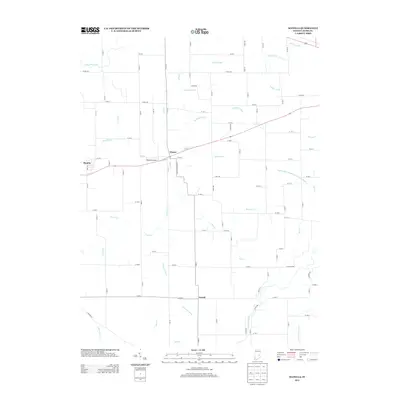
2013 Map of Manilla
USGS Topo · Published 2013About this map
Manilla and Homer serve as the primary hubs for this agricultural landscape in Rush County, where the settlement pattern follows a rigid grid of rural routes. The terrain is defined by an extensive network of water management features, including the Little Blue River in the northwest and the Flatrock River in the southeast. Named waterways like Conns Cr and Homer Run are augmented by numerous man-made channels such as Arbuckle Ditch and McGinnis Ditch, reflecting a highly engineered drainage system essential for the region's farming economy. Near the center of the map, the Webster Airport provides a small aviation waypoint, while S Hurst Cemetery Rd points toward local genealogical landmarks. The small community of Gowdy sits to the south, connected to the larger villages by a web of local roads that have maintained the county's rural character into the early 21st century.
Find a feature on this map
63 named features on this map. Tap any name to fly to it.
Don’t see what you’re looking for? This feature index may not catch every label — zoom into the map to look around manually.
Map Details
Editions of this 2013 Manilla Map
This is the sole edition of this map. No revisions or reprints were ever made.
Other maps of this area

1942 · Columbus
USGS Topo · 1:125,000

1953 · Cincinnati
USGS Topo · 1:250,000

1956 · Morristown
USGS Topo · 1:24,000

1956 · Waldron
USGS Topo · 1:24,000

1956 · Rays Crossing
USGS Topo · 1:24,000

1957 · Cincinnati
USGS Topo · 1:250,000

1959 · Milroy
USGS Topo · 1:24,000

1959 · Rushville
USGS Topo · 1:24,000
1959 · Adams
USGS Topo · 1:24,000

1959 · Mays
USGS Topo · 1:24,000