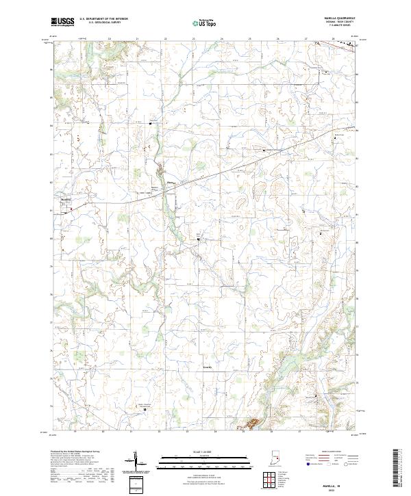
2022 Map of Manilla
USGS Topo · Published 2022About this map
Manilla and Homer serve as the primary anchors for this agricultural landscape in southwestern Rush County. The terrain is defined by a dense network of drainage infrastructure, such as Hodge Ditch, Arbuckle Ditch, and the curiously named Logan Nine Hundred Forty-Five Ditch, reflecting a long-standing history of water management to support local farming. The area is intersected by the Little Blue River in the northwest and the Flatrock River in the southeast, with Conns Creek winding through the central township sections.
Find a feature on this map
62 named features on this map. Tap any name to fly to it.
Don’t see what you’re looking for? This feature index may not catch every label — zoom into the map to look around manually.
Map Details
Editions of this 2022 Manilla Map
This is the sole edition of this map. No revisions or reprints were ever made.
Other maps of this area

1942 · Columbus
USGS Topo · 1:125,000

1953 · Cincinnati
USGS Topo · 1:250,000

1956 · Morristown
USGS Topo · 1:24,000

1956 · Waldron
USGS Topo · 1:24,000

1956 · Rays Crossing
USGS Topo · 1:24,000

1957 · Cincinnati
USGS Topo · 1:250,000

1959 · Milroy
USGS Topo · 1:24,000

1959 · Rushville
USGS Topo · 1:24,000
1959 · Adams
USGS Topo · 1:24,000

1959 · Mays
USGS Topo · 1:24,000