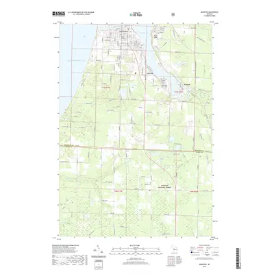
2019 Map of Manistee
USGS Topo · Published 2019About this map
The industrial and maritime hub of Manistee centers this map where the Manistee River flows from Manistee Lake into the vast expanse of Lake Michigan. The settlement pattern reflects a history of milling and shipping, with established communities like Filer City, Stronach, and East Lake ringing the inland lake. Further south, the landscape transitions from the urban grid and the Manistee County Courthouse to the protected woodlands of the Manistee National Forest, where smaller water bodies like King Lake and Shingle Mill Lake dot the terrain. Genealogists will find three distinct burial grounds: Mount Carmel Cem, Trinity Cem, and the more remote Long Lake Cem near the Manistee Co Mason Co line. The survey captures the contrast between the dense street network of the port city and the wetlands of Hornkohl Swamp and Gurney Creek to the southeast.
Find a feature on this map
83 named features on this map. Tap any name to fly to it.
Don’t see what you’re looking for? This feature index may not catch every label — zoom into the map to look around manually.
Map Details
Editions of this 2019 Manistee Map
This is the sole edition of this map. No revisions or reprints were ever made.
Other maps of this area

1931 · Manistee SE
USGS Topo · 1:31,680

1931 · Freesoil SW
USGS Topo · 1:31,680

1931 · Manistee SW
USGS Topo · 1:31,680

1954 · Manitowoc
USGS Topo · 1:250,000

1956 · Onekama
USGS Topo · 1:62,500

1956 · Bar Lake
USGS Topo · 1:62,500

1957 · Freesoil
USGS Topo · 1:62,500

1958 · Manitowoc
USGS Topo · 1:250,000

1958 · Manistee
USGS Topo · 1:62,500

1976 · Onekama SW
USGS Topo · 1:24,000