
1931 Map of Manistee SW
USGS Topo · Published 1931About this map
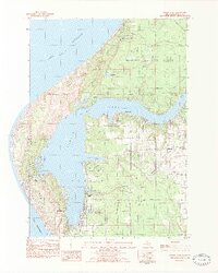
Big Sable Point and the complex shoreline of Hamlin Lake define this coastal landscape as it was documented in 1931. The map illustrates a distinctive transition where the Sable River is met by a Dam, creating the expansive waters of the lake with its numerous branching inlets like North Bayou, Middle Bayou, and Indian Pete Bayou. On the Lake Michigan coast, the Big Sable LH and a nearby Life Saving Station mark the maritime importance of this stretch of shore. Inland, the rural character of Grant and Hamlin townships is visible through small-scale landmarks including the Dewey Sch and Nordhouse Sch, alongside the specialized Bridges Resort. This survey, compiled from early Air Corps aerial photography, provides a clear view of the area's geography before significant modern development altered the woodland and bayou systems near Weimer.
Find a feature on this map
25 named features on this map. Tap any name to fly to it.
Don’t see what you’re looking for? This feature index may not catch every label — zoom into the map to look around manually.
Map Details
Editions of this 1931 Manistee SW Map
This is the sole edition of this map. No revisions or reprints were ever made.
Other maps of this area

1931 · Manistee SE
USGS Topo · 1:31,680

1932 · Ludington NE
USGS Topo · 1:31,680

1932 · Ludington
USGS Topo · 1:31,680

1954 · Milwaukee
USGS Topo · 1:250,000

1954 · Manitowoc
USGS Topo · 1:250,000

1958 · Manitowoc
USGS Topo · 1:250,000

1958 · Milwaukee
USGS Topo · 1:250,000

1958 · Manistee
USGS Topo · 1:62,500

1959 · Ludington
USGS Topo · 1:62,500
1982 · Hamlin Lake
USGS Topo · 1:25,000