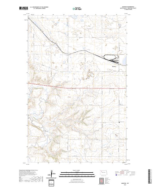
2024 Map of Manitou
USGS Topo · Published 2024About this map
The White Earth River carves a deep valley through the high prairie landscape of Mountrail County, revealing a terrain shaped by post-glacial drainage patterns. The river's winding course creates a sharp contrast to the rigid grid of the Public Land Survey System that governs the surrounding uplands. Near the eastern edge of this drainage, the Manitou settlement serves as a focal point for the regional transportation network, situated along the corridor of Co HWY 2 and existing rail infrastructure. The inclusion of the Bohemian Cem in the southeastern portion of the map provides a vital link to the European immigrant history of this corner of the state, marking where early settlers established roots in the North Dakota grasslands. Modern rural life is reflected in the extensive network of township roads, such as 66th ST NW and 98th ST NW, which facilitate the agriculture-driven economy of the High Plains today.
Find a feature on this map
22 named features on this map. Tap any name to fly to it.
Don’t see what you’re looking for? This feature index may not catch every label — zoom into the map to look around manually.
Map Details
Editions of this 2024 Manitou Map
This is the sole edition of this map. No revisions or reprints were ever made.
Other maps of this area

1953 · Williston
USGS Topo · 1:250,000

1957 · Williston
USGS Topo · 1:250,000

1965 · Charlson NE
USGS Topo · 1:24,000

1969 · Ross NW
USGS Topo · 1:24,000

1969 · White Earth
USGS Topo · 1:24,000

1979 · Tioga SE
USGS Topo · 1:24,000

1981 · Robinson Lake
USGS Topo · 1:24,000

1981 · Ross
USGS Topo · 1:24,000

1981 · Manitou
USGS Topo · 1:24,000
1981 · Rat Lake
USGS Topo · 1:24,000