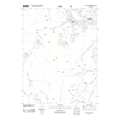
2011 Map of Manitou Springs
USGS Topo · Published 2011About this map
Manitou Springs and the surrounding Front Range canyons are documented here in a period of modern development integrated with the region's mining and recreation history. The map shows the intricate network of peaks and water features that define the area, including Mount Manitou, Cameron Cone, and the dramatic Seven Falls. Geologists and researchers will find specific interest in the mining claims and prospects south of the city, such as Duffields Mine and the Saint Peters Dome Pegmatite Prospect. Historic settlements and mountain outposts like Minnehaha, Midway, and Nelson Camp are located along the rugged drainages of Ruxton Creek and Bear Creek. The map also captures infrastructure critical to the urban centers below, notably Big Tooth Reservoir and the Valley Reservoir Number 1.
Find a feature on this map
100 named features on this map. Tap any name to fly to it.
Don’t see what you’re looking for? This feature index may not catch every label — zoom into the map to look around manually.
Map Details
Editions of this 2011 Manitou Springs Map
This is the sole edition of this map. No revisions or reprints were ever made.
Other maps of this area

1893 · Colorado Springs
USGS Topo · 1:125,000

1894 · Pikes Peak
USGS Topo · 1:125,000

1901 · Pikes Peak
USGS Topo · 1:125,000

1901 · Pikes Peak
USGS Topo · 1:62,500

1909 · Colorado Springs
USGS Topo · 1:125,000

1942 · Colorado Springs
USGS Topo · 1:125,000

1948 · Mount Big Chief
USGS Topo · 1:24,000

1948 · Manitou Springs
USGS Topo · 1:24,000

1948 · Colorado Springs
USGS Topo · 1:62,500

1948 · Pikeview
USGS Topo · 1:24,000