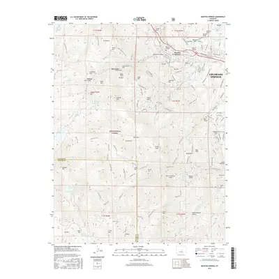
2016 Map of Manitou Springs
USGS Topo · Published 2016About this map
Manitou Springs and the western reaches of Colorado Springs dominate the northeastern corner of this 2016 survey, where the urban edge meets the steep ascent of the Pike National Forest. The map documents a vertical landscape defined by peaks and canyons, including Mt Manitou, Cameron Cone, and the dramatic rock formations at Balanced Rock. Genealogists and local historians will find the Crystal Valley Cem and Jackson Cem well-documented, alongside small mountain settlements like Minnehaha and Midway. Water management is a primary theme of the terrain, with the Manitou Reservoir, Lake Moraine, and Stratton Reservoir linked by a complex system of creek drainages and pipelines. The extensive network of paths, such as the famous Barr Trail, illustrates the region's long-standing focus on recreational access to the high-altitude wilderness surrounding Almagre Mtn.
Find a feature on this map
137 named features on this map. Tap any name to fly to it.
Don’t see what you’re looking for? This feature index may not catch every label — zoom into the map to look around manually.
Map Details
Editions of this 2016 Manitou Springs Map
This is the sole edition of this map. No revisions or reprints were ever made.
Other maps of this area

1893 · Colorado Springs
USGS Topo · 1:125,000

1894 · Pikes Peak
USGS Topo · 1:125,000

1901 · Pikes Peak
USGS Topo · 1:125,000

1901 · Pikes Peak
USGS Topo · 1:62,500

1909 · Colorado Springs
USGS Topo · 1:125,000

1942 · Colorado Springs
USGS Topo · 1:125,000

1948 · Mount Big Chief
USGS Topo · 1:24,000

1948 · Manitou Springs
USGS Topo · 1:24,000

1948 · Colorado Springs
USGS Topo · 1:62,500

1948 · Pikeview
USGS Topo · 1:24,000