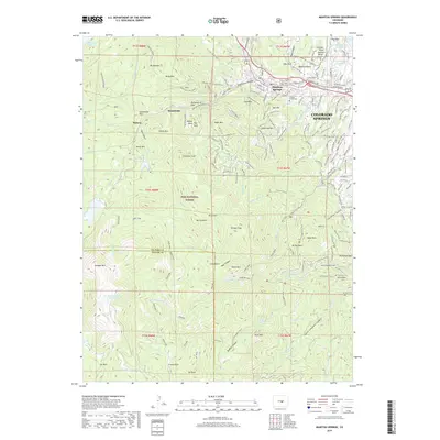
2019 Map of Manitou Springs
USGS Topo · Published 2019About this map
Manitou Springs and the western edge of Colorado Springs dominate the eastern reaches of this landscape, where the foothills meet the high peaks of the Pike National Forest. The map traces the steep ascent of the Manitou Incline Summit Trail and the Cog Railway route near Minnehaha and Midway, following the drainage of Ruxton Creek. To the south and west, the terrain rises sharply toward Cameron Cone and Almagre Mountain, punctuated by natural landmarks like Seven Falls and Helen Hunt Falls. Water management for the growing region is evident in the presence of Big Tooth Reservoir, Mount Baldy Reservoir, and Manitou Reservoir. The transition from the urban interface at Jackson Cemetery to the protected wilderness of Bear Canyon illustrates the complex geography of the Pikes Peak region.
Find a feature on this map
161 named features on this map. Tap any name to fly to it.
Don’t see what you’re looking for? This feature index may not catch every label — zoom into the map to look around manually.
Map Details
Editions of this 2019 Manitou Springs Map
This is the sole edition of this map. No revisions or reprints were ever made.
Other maps of this area

1893 · Colorado Springs
USGS Topo · 1:125,000

1894 · Pikes Peak
USGS Topo · 1:125,000

1901 · Pikes Peak
USGS Topo · 1:125,000

1901 · Pikes Peak
USGS Topo · 1:62,500

1909 · Colorado Springs
USGS Topo · 1:125,000

1942 · Colorado Springs
USGS Topo · 1:125,000

1948 · Mount Big Chief
USGS Topo · 1:24,000

1948 · Manitou Springs
USGS Topo · 1:24,000

1948 · Colorado Springs
USGS Topo · 1:62,500

1948 · Pikeview
USGS Topo · 1:24,000