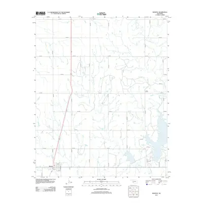
2012 Map of Manitou
USGS Topo · Published 2012About this map
The town of Manitou serves as the focal point for this Southwest Oklahoma landscape, situated where the high plains meet a intricate drainage network. The grid of the settlement is clearly defined by streets like Palmer Ave and 2nd St, reflecting its role as a regional center for the surrounding agricultural tracts. To the southeast, the expansive Lake Frederick dominates the topography, its shoreline reached by local routes such as Curtis Cove Rd. The hydrology of the area is particularly complex, defined by the winding paths of Deep Red Creek and its various tributaries, including W Fork Deep Red Creek and the ominously named Coffin Creek. For genealogists, the N Deep Red Cemetery provides a specific point of interest for tracing family ties to this corner of Tillman County. The map captures a moment of modern transition where traditional section lines and rural roads like E1670 Rd interface with these natural waterways and modern impoundments.
Find a feature on this map
30 named features on this map. Tap any name to fly to it.
Don’t see what you’re looking for? This feature index may not catch every label — zoom into the map to look around manually.
Map Details
Editions of this 2012 Manitou Map
This is the sole edition of this map. No revisions or reprints were ever made.
Other maps of this area

1950 · Snyder
USGS Topo · 1:62,500

1955 · Lawton
USGS Topo · 1:250,000

1956 · Odetta
USGS Topo · 1:24,000

1956 · Manitou
USGS Topo · 1:24,000

1956 · Snyder
USGS Topo · 1:24,000

1956 · Indiahoma
USGS Topo · 1:24,000

1956 · Snyder
USGS Topo · 1:62,500

1958 · Frederick
USGS Topo · 1:62,500

1964 · Tipton SE
USGS Topo · 1:24,000

1964 · Long Mountain
USGS Topo · 1:24,000