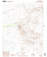
1982 Map of Manix
USGS Topo · Published 1993About this map
The Mojave River winds through this high desert corridor in the early 1980s, carving a green-tinted valley between the Cady Mountains and the northern Mojave Valley. The landscape is defined by the vital transit routes that follow this natural basin, including the heavy rail lines of the Union Pacific and the path of Interstate 15. Historical markers of settlement and survival are scattered across the arid terrain, from the Camp Cady (Site) and nearby Camp Cady Ranch to the lonely Fourmile Waterhole along the riverbed. Water remains the dominant theme in this dry expanse, evidenced by the presence of Cady Spring and the vast Troy Lake (Dry) to the south. Distinctive geological features like Soldier Mtn, The Knob, and shifting Sand Dunes rise above the alluvial washes, while the Vortac Facility near Manix represents the mid-century's technological layer upon this ancient desert crossing.
Find a feature on this map
17 named features on this map. Tap any name to fly to it.
Don’t see what you’re looking for? This feature index may not catch every label — zoom into the map to look around manually.
Map Details
Editions of this 1982 Manix Map
4 editions found
Other maps of this area

1933 · Avawatz Mountains
USGS Topo · 1:250,000

1947 · Trona
USGS Topo · 1:250,000

1948 · Trona
USGS Topo · 1:250,000

1948 · Alvord Mountain
USGS Topo · 1:62,500

1948 · Cave Mountain
USGS Topo · 1:62,500

1951 · Cave Mountain
USGS Topo · 1:62,500

1951 · Alvord Mountain
USGS Topo · 1:62,500

1953 · San Bernardino
USGS Topo · 1:250,000

1953 · Trona
USGS Topo · 1:250,000

1955 · Newberry
USGS Topo · 1:62,500