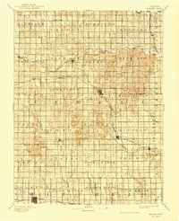
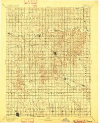
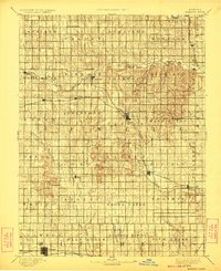
1894 Map of Mankato
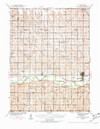
USGS Topo · Published 1944About this map
Mankato serves as the central hub for Jewell County in this late-19th-century survey, revealing a landscape defined by the rapid expansion of the American rail system. The intersection of major lines, including the Chicago Rock Island and Pacific Railway and the Missouri Pacific Railway, illustrates how steam-age transportation dictated the growth of prairie settlements. Many of these towns, such as Esbon and Otego, are positioned directly along these corridors, while older or more isolated hamlets like Salem reflect the pre-rail patterns of the region.
Find a feature on this map
61 named features on this map. Tap any name to fly to it.
Don’t see what you’re looking for? This feature index may not catch every label — zoom into the map to look around manually.
Map Details
Editions of this 1894 Mankato Map
4 editions found
Other maps of this area

1892 · Concordia
USGS Topo · 1:125,000

1892 · Minneapolis
USGS Topo · 1:125,000

1893 · Smith Center
USGS Topo · 1:125,000

1894 · Mankato
USGS Topo · 1:125,000

1894 · Beloit
USGS Topo · 1:125,000

1896 · Osborne
USGS Topo · 1:125,000

1897 · Red Cloud
USGS Topo · 1:125,000

1898 · Superior
USGS Topo · 1:125,000

1898 · Hebron
USGS Topo · 1:125,000
1940 · Red Cloud
USGS Topo · 1:62,500