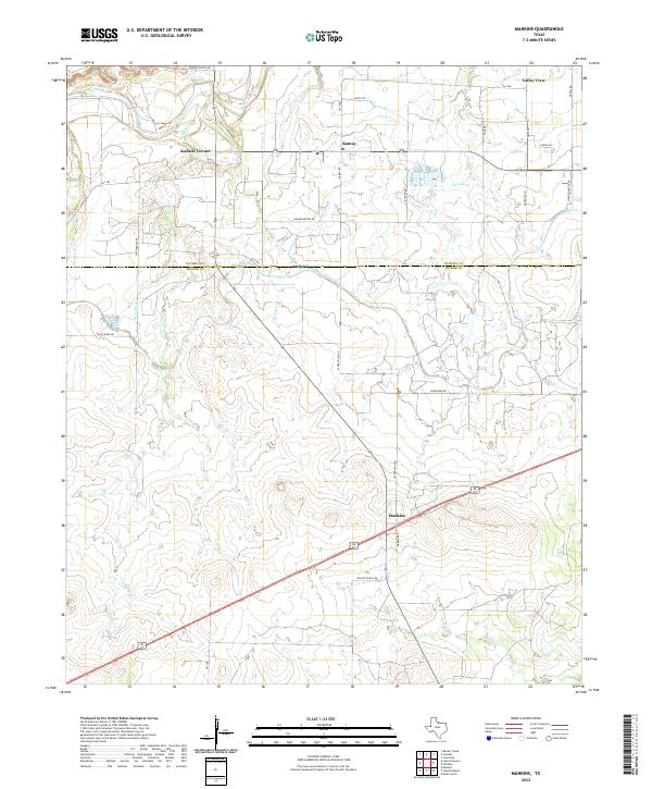
2022 Map of Mankins
USGS Topo · Published 2022About this map
Mankins serves as the focal point of this North Texas landscape, situated along a primary transportation corridor near the boundary between Wichita Co and Archer Co. The 2022 survey reveals a region defined by its water management and agricultural infrastructure, most notably the prominent South-Side Canal and an intricate network of irrigation laterals, including the SJ Lateral, SK Lateral, and SL Lateral. Small settlements and named crossroads like Kadane Corner, Kamay, and Valley View punctuate the grid of ranch roads, while the natural drainage of the Wichita River and Bull Cr provides topographic relief to the surrounding plains. Local history is etched into the landscape through family-named landmarks and thoroughfares such as Bradley Ranch Rd and Wilson Ranch Rd, reflecting the enduring ranching heritage of this section of the Texas Panhandle.
Find a feature on this map
38 named features on this map. Tap any name to fly to it.
Don’t see what you’re looking for? This feature index may not catch every label — zoom into the map to look around manually.
Map Details
Editions of this 2022 Mankins Map
This is the sole edition of this map. No revisions or reprints were ever made.
Other maps of this area

1916 · Iowa Park
USGS Topo · 1:24,000

1916 · Fowlkes
USGS Topo · 1:24,000

1917 · Beaver Creek
USGS Topo · 1:24,000

1918 · Iowa Park
USGS Topo · 1:31,680

1919 · Fowlkes
USGS Topo · 1:31,680

1920 · Beaver Creek
USGS Topo · 1:31,680

1931 · Archer City
USGS Topo · 1:62,500

1932 · Dundee
USGS Topo · 1:62,500

1954 · Wichita Falls
USGS Topo · 1:250,000

1957 · Wichita Falls West
USGS Topo · 1:62,500