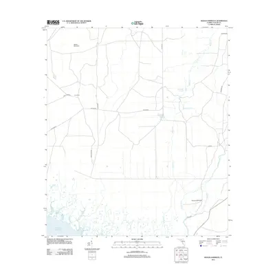
2012 Map of Manlin Hammock
USGS Topo · Published 2012About this map
Manlin Hammock and the surrounding coastal wetlands of Taylor County define this landscape along the northeastern edge of the Gulf of Mexico. This territory is characterized by complex drainage networks where Regular Cr and Smokehouse Cr feed into the Steer Pen Slough. The southern reach of the map reveals the winding course of the Fenholloway River and the distinct landforms of Thomas Mill Island and Thomas Mill Run, areas historically significant for their river-dependent utility. Cultural markers are sparse but notable, including the evocatively named Camp Misery and the inland hammocks like Mossy Hammock. The infrastructure is dominated by the logging and transit routes of Buckeye Rd and Container Rd, reflecting the region's long-standing connection to the timber industry. Researchers will find a detailed representation of the transitional terrain between the swampy interior and the tidal influences of the gulf.
Find a feature on this map
17 named features on this map. Tap any name to fly to it.
Don’t see what you’re looking for? This feature index may not catch every label — zoom into the map to look around manually.
Map Details
Editions of this 2012 Manlin Hammock Map
This is the sole edition of this map. No revisions or reprints were ever made.
Other maps of this area

1952 · Secotan
USGS Topo · 1:24,000

1954 · Johnson Hammock
USGS Topo · 1:24,000

1954 · Hampton Springs
USGS Topo · 1:24,000

1954 · Secotan
USGS Topo · 1:24,000

1954 · Okefenokee Slough
USGS Topo · 1:24,000

1954 · Gainesville
USGS Topo · 1:250,000

1954 · Valdosta
USGS Topo · 1:250,000

1955 · Snipe Island
USGS Topo · 1:24,000

1955 · Nutall Rise
USGS Topo · 1:24,000

1955 · Rock Islands
USGS Topo · 1:24,000