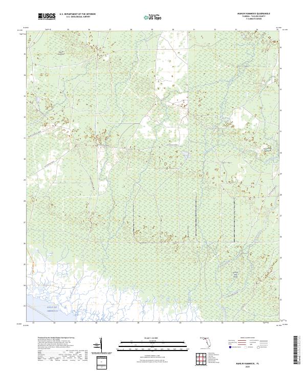
2025 Map of Manlin Hammock
USGS Topo · Published 2025About this map
Manlin Hammock and the low-lying wetlands of Taylor County define this coastal landscape where the Gulf of America meets a complex network of tidal creeks and hammocks. The map reveals a transition from inland pine and swamp terrain to the open water, characterized by named hammocks like Thomas Mill Hammock and the secluded Thomas Mill Island. These elevated landforms serve as critical dry ground within the surrounding marsh, often linked by historic timber or access paths such as the Mossey Hammock Grade and Rattlesnake Grade.
Find a feature on this map
17 named features on this map. Tap any name to fly to it.
Don’t see what you’re looking for? This feature index may not catch every label — zoom into the map to look around manually.
Map Details
Editions of this 2025 Manlin Hammock Map
This is the sole edition of this map. No revisions or reprints were ever made.
Other maps of this area

1952 · Secotan
USGS Topo · 1:24,000

1954 · Johnson Hammock
USGS Topo · 1:24,000

1954 · Hampton Springs
USGS Topo · 1:24,000

1954 · Secotan
USGS Topo · 1:24,000

1954 · Okefenokee Slough
USGS Topo · 1:24,000

1954 · Gainesville
USGS Topo · 1:250,000

1954 · Valdosta
USGS Topo · 1:250,000

1955 · Snipe Island
USGS Topo · 1:24,000

1955 · Nutall Rise
USGS Topo · 1:24,000

1955 · Rock Islands
USGS Topo · 1:24,000