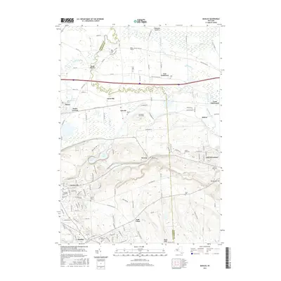
2016 Map of Manlius
USGS Topo · Published 2016About this map
Chittenango Creek and Limestone Creek carve through this Central New York landscape, defining the boundaries and drainage patterns between Chittenango, Fayetteville, and Manlius. The map documents a complex network of early 21st-century suburban expansion and rural preservation, particularly evident around the glacial features of Green Lake and Round Lake. For those tracing local history, several smaller locales such as Fyler Settlement, North Manlius, and Eagle Village are preserved alongside a surprising concentration of small burial sites, including the Mycenae Burial Ground and the Anguish Family Cem. Modern infrastructure like the Poolsbrook Aerodrome and several major highway corridors intersect with the older agricultural foundations of the region, where names like Snyder Crossing and Weaver Corner speak to the area's older transportation roots.
Find a feature on this map
122 named features on this map. Tap any name to fly to it.
Don’t see what you’re looking for? This feature index may not catch every label — zoom into the map to look around manually.
Map Details
Editions of this 2016 Manlius Map
This is the sole edition of this map. No revisions or reprints were ever made.
Other maps of this area

1895 · Chittenango
USGS Topo · 1:62,500

1895 · Syracuse
USGS Topo · 1:62,500

1897 · Cazenovia
USGS Topo · 1:62,500

1898 · Syracuse
USGS Topo · 1:62,500

1898 · Chittenango
USGS Topo · 1:62,500

1899 · Cazenovia
USGS Topo · 1:62,500

1900 · Tully
USGS Topo · 1:62,500

1902 · Chittenango
USGS Topo · 1:62,500

1938 · Syracuse East
USGS Topo · 1:24,000

1940 · Cicero
USGS Topo · 1:24,000