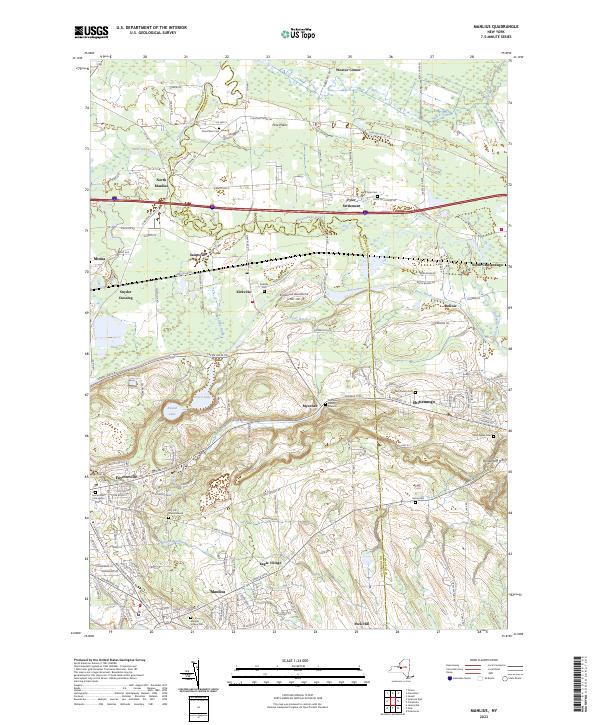
2023 Map of Manlius
USGS Topo · Published 2023About this map
Limestone Creek and Chittenango Creek define the drainage of this central New York landscape, where historical hamlets and burial grounds are scattered between the developing hubs of Fayetteville and Manlius. The map details the transition from the flatlands around North Manlius and Fyler Settlement to the rising elevations of Peck Hill and Brinkerhoff Hill. A notable concentration of small, family-associated burial sites, such as the Anguish Family Cem and Mycenae Burial Ground, speaks to the deep-rooted agricultural ancestry of the region. The infrastructure of the CSX railroad corridor and the Poolsbrook Aerodrome intersect with older landmarks like the Genesee Tpke, illustrating the layers of transport history. Unusual geological features like Green Lake and Round Lake provide distinct landmarks within the broader glacial terrain of Chestnut Ridge.
Find a feature on this map
138 named features on this map. Tap any name to fly to it.
Don’t see what you’re looking for? This feature index may not catch every label — zoom into the map to look around manually.
Map Details
Editions of this 2023 Manlius Map
This is the sole edition of this map. No revisions or reprints were ever made.
Other maps of this area

1895 · Chittenango
USGS Topo · 1:62,500

1895 · Syracuse
USGS Topo · 1:62,500

1897 · Cazenovia
USGS Topo · 1:62,500

1898 · Syracuse
USGS Topo · 1:62,500

1898 · Chittenango
USGS Topo · 1:62,500

1899 · Cazenovia
USGS Topo · 1:62,500

1900 · Tully
USGS Topo · 1:62,500

1902 · Chittenango
USGS Topo · 1:62,500

1938 · Syracuse East
USGS Topo · 1:24,000

1940 · Cicero
USGS Topo · 1:24,000