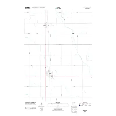
2013 Map of Manly
USGS Topo · Published 2013About this map
Manly serves as the primary hub of this North Central Iowa landscape, situated at a crossroads of transportation and agriculture. The town's grid is bisected by major transit corridors, while the surrounding countryside is defined by the drainage patterns of Beaver Cr and the Shell Rock River. To the north, the smaller settlement of Kensett is accompanied by the label Kinsett, suggesting a local variation or specific district. The rural character of Worth County is evident in the strictly rectilinear road network, including routes like Nettle Ave and Quail Ave, which navigate around natural watercourses such as Elk Cr and Spring Cr. This survey illustrates the modern agricultural footprint of the region, where managed waterways like Ditch Number 53 supplement the natural river systems to support the fertile prairie lands between Glade and the outlying farmsteads.
Find a feature on this map
53 named features on this map. Tap any name to fly to it.
Don’t see what you’re looking for? This feature index may not catch every label — zoom into the map to look around manually.
Map Details
Editions of this 2013 Manly Map
This is the sole edition of this map. No revisions or reprints were ever made.
Other maps of this area

1954 · Mason City
USGS Topo · 1:250,000

1957 · Mason City
USGS Topo · 1:250,000

1958 · Mason City
USGS Topo · 1:250,000

1959 · Mason City
USGS Topo · 1:24,000

1959 · Mason City
USGS Topo · 1:62,500

1959 · Nora Springs
USGS Topo · 1:24,000

1972 · Manly
USGS Topo · 1:24,000

1972 · Northwood
USGS Topo · 1:24,000

1972 · Fertile NE
USGS Topo · 1:24,000
1972 · Clear Lake East
USGS Topo · 1:24,000