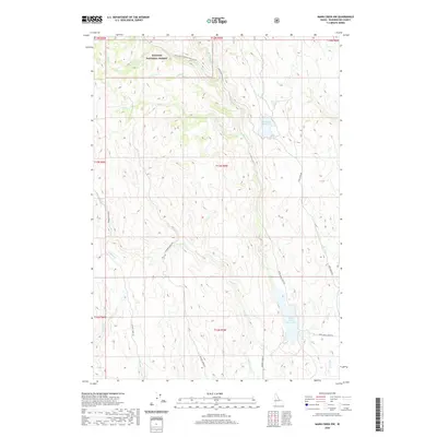
2020 Map of Mann Creek NW
USGS Topo · Published 2020About this map
Payette National Forest dominates the northern reaches of this Washington County landscape, where high-elevation drainages like Adams Cr and Fir Cr feed into the regional water system. The topographic detail captured by the U.S. Geological Survey illustrates a rugged network of ridges and creek beds that defined the movement of early settlers and ranching operations. Significant water management is evident at the Mann Creek Reservoir and Fairchild Reservoir, which serve as critical hubs for the surrounding terrain. Access to these higher elevations is provided by a network of established routes, including Upper Mann Creek Rd and Chicken Creek Rd, which follow the natural contours of the land. This survey provides a clear view of the complex hydrology of the area, from the headwaters of Sage Cr to the southern reaches of Monroe Cr.
Find a feature on this map
26 named features on this map. Tap any name to fly to it.
Don’t see what you’re looking for? This feature index may not catch every label — zoom into the map to look around manually.
Map Details
Editions of this 2020 Mann Creek NW Map
This is the sole edition of this map. No revisions or reprints were ever made.
Other maps of this area

1897 · Weiser
USGS Topo · 1:125,000

1915 · Pine
USGS Topo · 1:125,000

1952 · Olds Ferry
USGS Topo · 1:62,500

1952 · Olds Ferry SE
USGS Topo · 1:24,000

1953 · Mann Creek
USGS Topo · 1:62,500

1955 · Baker
USGS Topo · 1:250,000

1957 · Sturgill Peak
USGS Topo · 1:62,500

1957 · Mineral
USGS Topo · 1:62,500

1959 · Baker
USGS Topo · 1:250,000
1974 · Mann Creek SW
USGS Topo · 1:24,000