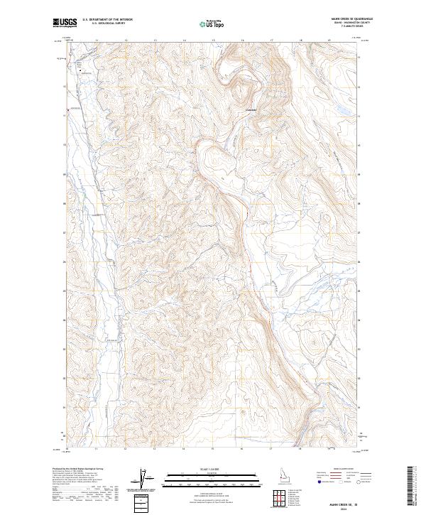
2024 Map of Mann Creek SE
USGS Topo · Published 2024About this map
Mann Creek and the Weiser River dominate this Washington County landscape, where agricultural water management and historical transportation routes converge. The irrigation network is evidenced by the Sunnyside Canal in the southeast, supporting the valley's development. Near the confluence of several local roads, including Mann Creek Rd and Cemetery Rd, the Mann Creek Cem stands as a primary point of interest for genealogical research. The terrain transitions from the river bottomlands up into the draws and ridges of the surrounding highlands, including the starkly named Dead Man Gulch. Modern recreational use is represented by the Weiser River National Recreation Trl, which follows the river's winding course past the settlement of Concrete.
Find a feature on this map
25 named features on this map. Tap any name to fly to it.
Don’t see what you’re looking for? This feature index may not catch every label — zoom into the map to look around manually.
Map Details
Editions of this 2024 Mann Creek SE Map
This is the sole edition of this map. No revisions or reprints were ever made.
Other maps of this area

1897 · Weiser
USGS Topo · 1:125,000

1951 · Weiser South
USGS Topo · 1:24,000

1952 · Weiser Cove
USGS Topo · 1:24,000

1953 · Mann Creek
USGS Topo · 1:62,500

1955 · Baker
USGS Topo · 1:250,000

1957 · Crane Creek Reservoir
USGS Topo · 1:62,500

1959 · Baker
USGS Topo · 1:250,000
1970 · Holland Gulch
USGS Topo · 1:24,000
1974 · Weiser South
USGS Topo · 1:24,000
1974 · Mann Creek SW
USGS Topo · 1:24,000